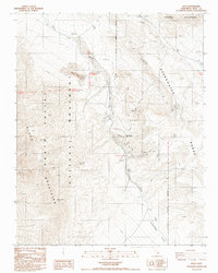
1988 Map of Ryan
USGS Topo · Published 1988About this map
Ryan and the settlement of Ryan Widow anchor this 1988 survey, located at the eastern edge of Death Valley National Monument. The landscape is dominated by industrial mining history, with the Sigma Mine, Billie Mine, and Boraxo Mine marking significant mineral operations between the Black Mountains and the Greenwater Range. Transport corridors are defined by the rugged Gouge Eye path and a prominent Old RR Grade, which winds through the hills toward the Funeral Mountains. This map documents a desert environment where water sources like Lemonade Spring were critical for survival and industry. The presence of Ruins, a Cem, and scattered prospects provides a clear view of the transitory nature of high-desert mining camps. Modern infrastructure, including a Radio Tower, sits alongside these relics of the previous century's extraction efforts.
Find a feature on this map
24 named features on this map. Tap any name to fly to it.
Don’t see what you’re looking for? This feature index may not catch every label — zoom into the map to look around manually.
Map Details
Editions of this 1988 Ryan Map
This is the sole edition of this map. No revisions or reprints were ever made.
Other maps of this area

1908 · Furnace Creek
USGS Topo · 1:250,000

1910 · Furnace Creek
USGS Topo · 1:250,000

1948 · Death Valley
USGS Topo · 1:250,000

1951 · Funeral Peak
USGS Topo · 1:62,500

1952 · Furnace Creek
USGS Topo · 1:62,500

1952 · Ryan
USGS Topo · 1:62,500

1952 · Bennetts Well
USGS Topo · 1:62,500

1954 · Death Valley
USGS Topo · 1:250,000

1956 · Death Valley
USGS Topo · 1:250,000

1957 · Death Valley
USGS Topo · 1:250,000