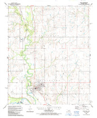
1987 Map of Ryan
USGS Topo · Published 1988About this map
Ryan serves as the primary hub of this Jefferson County landscape, positioned where the Oklahoma Kansas and Texas railroad intersects the regional drainage of Beaver Creek. This 1980s-era survey documents the town's grid and infrastructure, including the Ryan Cem and several municipal facilities such as a Substation and Sewage Disposal Pond. To the northwest, the smaller settlement of Sugden sits near the winding course of Beaver Creek, illustrating the relationship between the rail corridor and the water-carved terrain of the Grayson and Patterson districts.
Find a feature on this map
21 named features on this map. Tap any name to fly to it.
Don’t see what you’re looking for? This feature index may not catch every label — zoom into the map to look around manually.
Map Details
Editions of this 1987 Ryan Map
This is the sole edition of this map. No revisions or reprints were ever made.
Other maps of this area

1901 · Addington
USGS Topo · 1:125,000

1905 · Montague
USGS Topo · 1:125,000

1954 · Sherman
USGS Topo · 1:250,000

1954 · Wichita Falls
USGS Topo · 1:250,000

1955 · Lawton
USGS Topo · 1:250,000

1956 · Henrietta
USGS Topo · 1:62,500

1957 · Hastings
USGS Topo · 1:62,500

1957 · Ardmore
USGS Topo · 1:250,000

1958 · Wichita Falls
USGS Topo · 1:250,000

1958 · Sherman
USGS Topo · 1:250,000