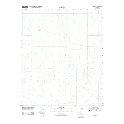
2009 Map of Ryan NE
USGS Topo · Published 2009About this map
Crooked Creek meanders through the central and eastern portions of this Jefferson County landscape, highlighting a region defined by its complex drainage systems and rural section-line roads. This 2009 survey reveals an area primarily structured around agriculture and water management, where the Allen Gss Number 2 Dam represents a significant local alteration to the natural hydrology. The map captures the convergence of several major waterways, including Mud Creek in the northeast and West Mud Creek in the southwest, illustrating the watershed's importance to the local geography.
Find a feature on this map
16 named features on this map. Tap any name to fly to it.
Don’t see what you’re looking for? This feature index may not catch every label — zoom into the map to look around manually.
Map Details
Editions of this 2009 Ryan NE Map
This is the sole edition of this map. No revisions or reprints were ever made.
Other maps of this area

1901 · Addington
USGS Topo · 1:125,000

1957 · Ardmore
USGS Topo · 1:250,000

1962 · Ryan
USGS Topo · 1:62,500

1963 · Ardmore
USGS Topo · 1:250,000

1964 · Comanche SE
USGS Topo · 1:24,000

1964 · Comanche
USGS Topo · 1:24,000

1974 · Ringling NW
USGS Topo · 1:24,000

1974 · Loco
USGS Topo · 1:24,000
1974 · Grady
USGS Topo · 1:24,000
1986 · Ardmore
USGS Topo · 1:100,000