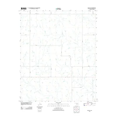
2012 Map of Ryan NE
USGS Topo · Published 2012About this map
Mud Cr and its winding tributaries define the rural landscape of Jefferson County in this 2012 survey. The terrain is characterized by a dense network of seasonal drainages, including Crooked Cr and Post Oak Cr, which cut through the agricultural sections of the Oklahoma prairie. The map shows a transition from earlier settlement patterns to a modern grid system of section roads, with Monument Hill Rd anchoring the northern boundary. While largely unpopulated by large towns, the map provides an intricate look at the local watercourses and the W Mud Cr fork, essential data for understanding the historical hydrology and land use in this part of the state.
Find a feature on this map
17 named features on this map. Tap any name to fly to it.
Don’t see what you’re looking for? This feature index may not catch every label — zoom into the map to look around manually.
Map Details
Editions of this 2012 Ryan NE Map
This is the sole edition of this map. No revisions or reprints were ever made.
Other maps of this area

1901 · Addington
USGS Topo · 1:125,000

1957 · Ardmore
USGS Topo · 1:250,000

1962 · Ryan
USGS Topo · 1:62,500

1963 · Ardmore
USGS Topo · 1:250,000

1964 · Comanche SE
USGS Topo · 1:24,000

1964 · Comanche
USGS Topo · 1:24,000

1974 · Ringling NW
USGS Topo · 1:24,000

1974 · Loco
USGS Topo · 1:24,000
1974 · Grady
USGS Topo · 1:24,000
1986 · Ardmore
USGS Topo · 1:100,000