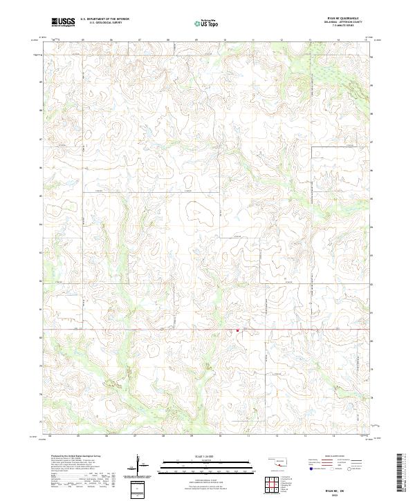
2022 Map of Ryan NE
USGS Topo · Published 2022About this map
Mud Cr and its various tributaries define the low-lying drainage patterns of this Jefferson County landscape, where the seasonal movement of water across the plains has historically dictated land use and road placement. The section lines of the Public Land Survey System are clearly visible, with a grid of rural roads such as e1910 RD and n2900 RD dividing the terrain into a patchwork of agricultural and grazing lands. This 2022 survey captures the modern road network, including uniquely named thoroughfares like Howard Brooks Bennett Blvd and Steven Howard Blvd. These family-named roads, alongside Dickey Browder Rd, suggest a lineage of local land ownership and community history that persists alongside the natural features of Crooked Cr and Post Oak Cr. The map provides a detailed view of the drainage basins and the intersection of traditional section-line farming with contemporary naming conventions.
Find a feature on this map
25 named features on this map. Tap any name to fly to it.
Don’t see what you’re looking for? This feature index may not catch every label — zoom into the map to look around manually.
Map Details
Editions of this 2022 Ryan NE Map
This is the sole edition of this map. No revisions or reprints were ever made.
Other maps of this area

1901 · Addington
USGS Topo · 1:125,000

1957 · Ardmore
USGS Topo · 1:250,000

1962 · Ryan
USGS Topo · 1:62,500

1963 · Ardmore
USGS Topo · 1:250,000

1964 · Comanche SE
USGS Topo · 1:24,000

1964 · Comanche
USGS Topo · 1:24,000

1974 · Ringling NW
USGS Topo · 1:24,000

1974 · Loco
USGS Topo · 1:24,000
1974 · Grady
USGS Topo · 1:24,000
1986 · Ardmore
USGS Topo · 1:100,000