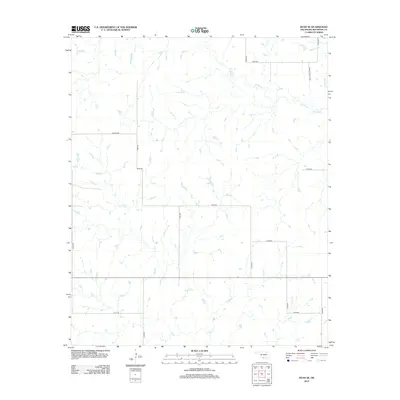
2012 Map of Ryan SE
USGS Topo · Published 2012About this map
Red Cr and its tributaries carve a network of drainage across this Jefferson County landscape, shaping a rural terrain defined by section-line roads and expansive water management. The mapping of W Mud Cr and Post Oak Cr in the northeast quadrant reveals a hydraulic pattern common to the region's agricultural and ranching parcels. The presence of Ernest Dickey Blvd provides a specific named landmark amidst a strictly numerical grid of thoroughfares like N2920 Rd and E2030 Rd. This 2012 survey by the U.S. Geological Survey reflects the modern infrastructure of Southern Oklahoma, where the intersection of traditional land divisions and natural watercourses continues to dictate the local geography.
Find a feature on this map
16 named features on this map. Tap any name to fly to it.
Don’t see what you’re looking for? This feature index may not catch every label — zoom into the map to look around manually.
Map Details
Editions of this 2012 Ryan SE Map
This is the sole edition of this map. No revisions or reprints were ever made.
Other maps of this area

1901 · Addington
USGS Topo · 1:125,000

1905 · Montague
USGS Topo · 1:125,000

1954 · Sherman
USGS Topo · 1:250,000

1957 · Ardmore
USGS Topo · 1:250,000

1958 · Sherman
USGS Topo · 1:250,000

1962 · Ryan
USGS Topo · 1:62,500

1963 · Ardmore
USGS Topo · 1:250,000
1968 · Terral
USGS Topo · 1:24,000

1968 · Fleetwood
USGS Topo · 1:24,000
1968 · Prairie Valley School
USGS Topo · 1:24,000