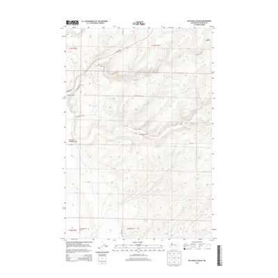
2013 Map of Rye Grass Coulee
USGS Topo · Published 2013About this map
Rye Grass Coulee and Smith Canyon dominate this arid portion of the Columbia Basin in Franklin County, where the landscape is defined by deep drainage systems and long ridgelines. The area shows a sparse network of service roads and land management divisions, including Blackman Ridge Rd and Statney Rd, which navigate the elevation changes between the coulee floor and the surrounding plateaus. The topography here reflects the distinctive geologic erosion of the region, captured shortly after the turn of the millennium. The survey provides a clear view of how rural infrastructure like Smith Canyon Rd and E Elm Rd aligns with the section lines of the Public Land Survey System, a vital reference for property researchers and local historians studying the rural development of this central Washington territory.
Find a feature on this map
15 named features on this map. Tap any name to fly to it.
Don’t see what you’re looking for? This feature index may not catch every label — zoom into the map to look around manually.
Map Details
Editions of this 2013 Rye Grass Coulee Map
This is the sole edition of this map. No revisions or reprints were ever made.
Other maps of this area

1915 · Wallulah
USGS Topo · 1:96,000

1916 · Connell
USGS Topo · 1:125,000

1917 · Pasco
USGS Topo · 1:125,000

1918 · Connell
USGS Topo · 1:125,000

1918 · Wallula
USGS Topo · 1:125,000

1925 · Scooteney Lake
USGS Topo · 1:62,500

1951 · Scooteney Lake
USGS Topo · 1:62,500

1953 · Walla Walla
USGS Topo · 1:250,000

1958 · Walla Walla
USGS Topo · 1:250,000

1963 · Rye Grass Coulee
USGS Topo · 1:24,000