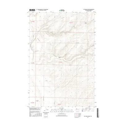
2017 Map of Rye Grass Coulee
USGS Topo · Published 2017About this map
Rye Grass Coulee and Smith Canyon dominate this agricultural landscape in Franklin County, illustrating the distinctive drainage patterns and topographical character of the Columbia Basin. The map details a transition from rugged coulee terrain to the developed farmsteads and specialized infrastructure of modern Washington agriculture, anchored by the Columbia Ag 2 Airport in the southwest. A grid of rural roads, including Blackman Ridge Rd and Blanton Rd, reveals the legacy of public land surveys and private property boundaries. Family-named landmarks such as Samual Brown Trail Rd, Bengen Ln, and Hummel Ln provide valuable touchpoints for genealogists and local historians tracing the settlement and development of the region's productive farmlands.
Find a feature on this map
18 named features on this map. Tap any name to fly to it.
Don’t see what you’re looking for? This feature index may not catch every label — zoom into the map to look around manually.
Map Details
Editions of this 2017 Rye Grass Coulee Map
This is the sole edition of this map. No revisions or reprints were ever made.
Other maps of this area

1915 · Wallulah
USGS Topo · 1:96,000

1916 · Connell
USGS Topo · 1:125,000

1917 · Pasco
USGS Topo · 1:125,000

1918 · Connell
USGS Topo · 1:125,000

1918 · Wallula
USGS Topo · 1:125,000

1925 · Scooteney Lake
USGS Topo · 1:62,500

1951 · Scooteney Lake
USGS Topo · 1:62,500

1953 · Walla Walla
USGS Topo · 1:250,000

1958 · Walla Walla
USGS Topo · 1:250,000

1963 · Rye Grass Coulee
USGS Topo · 1:24,000