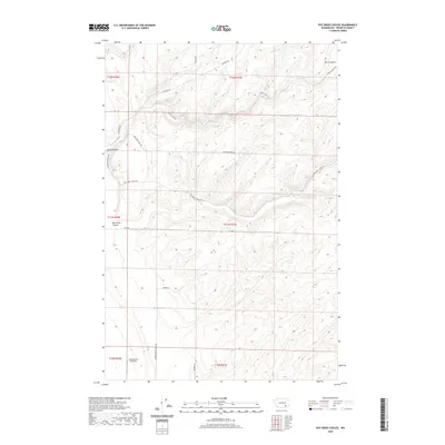
2020 Map of Rye Grass Coulee
USGS Topo · Published 2020About this map
Smith Canyon and the winding drainages of Rye Grass Coulee define the landscape of this agricultural region in southern Franklin County. The map details a network of rural routes and farm-to-market roads that provide access to the high plateau country, including Statsney Rd, Blanton Rd, and Blackman Ridge Rd. This 2020 survey illustrates the modernization of rural transport and specialized land use, notably featuring the Columbia Ag 2 Airport in the southwestern section. The topography is shaped by deeply incised coulees and ridges, with family-named infrastructure such as Bengen Ln and Samuel Brown Trail Rd tracing the history of local land ownership and movement through the high desert terrain.
Find a feature on this map
19 named features on this map. Tap any name to fly to it.
Don’t see what you’re looking for? This feature index may not catch every label — zoom into the map to look around manually.
Map Details
Editions of this 2020 Rye Grass Coulee Map
This is the sole edition of this map. No revisions or reprints were ever made.
Other maps of this area

1915 · Wallulah
USGS Topo · 1:96,000

1916 · Connell
USGS Topo · 1:125,000

1917 · Pasco
USGS Topo · 1:125,000

1918 · Connell
USGS Topo · 1:125,000

1918 · Wallula
USGS Topo · 1:125,000

1925 · Scooteney Lake
USGS Topo · 1:62,500

1951 · Scooteney Lake
USGS Topo · 1:62,500

1953 · Walla Walla
USGS Topo · 1:250,000

1958 · Walla Walla
USGS Topo · 1:250,000

1963 · Rye Grass Coulee
USGS Topo · 1:24,000