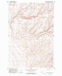
1991 Map of Rye Grass Coulee
USGS Topo · Published 1992About this map
Rye Grass Coulee cuts through this arid stretch of Franklin County, showing a landscape defined by dramatic geological formations and remote infrastructure at the start of the 1990s. The map illustrates a high-desert environment where natural features like Smith Canyon and Blackman Ridge Road are the primary landmarks. In the southeastern corner, the Juniper Dunes Wilderness begins to emerge, highlighting a protected pocket of shifting sands and native vegetation. Small-scale industrial activity is evidenced by a Sandpit and scattered Storage Bins, while a prominent Pipeline and several unimproved tracks like Blanton Road and Stastney Road navigate the ridges. This survey is particularly useful for understanding the rural road network and topography of the Washington interior before modern development intensified in the Columbia Basin.
Find a feature on this map
14 named features on this map. Tap any name to fly to it.
Don’t see what you’re looking for? This feature index may not catch every label — zoom into the map to look around manually.
Map Details
Editions of this 1991 Rye Grass Coulee Map
This is the sole edition of this map. No revisions or reprints were ever made.
Other maps of this area

1915 · Wallulah
USGS Topo · 1:96,000

1916 · Connell
USGS Topo · 1:125,000

1917 · Pasco
USGS Topo · 1:125,000

1918 · Connell
USGS Topo · 1:125,000

1918 · Wallula
USGS Topo · 1:125,000

1925 · Scooteney Lake
USGS Topo · 1:62,500

1951 · Scooteney Lake
USGS Topo · 1:62,500

1953 · Walla Walla
USGS Topo · 1:250,000

1958 · Walla Walla
USGS Topo · 1:250,000

1963 · Rye Grass Coulee
USGS Topo · 1:24,000