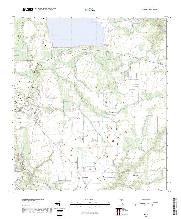
2024 Map of Rye
USGS Topo · Published 2024About this map
Manatee River waters define the southern edge of this landscape, winding westward from the upper reaches of Lake Manatee. The settlement of Rye sits at a historic junction near the river, where residential growth begins to intersect with the vast agricultural and drainage networks of eastern Manatee County. Moving north, the terrain transitions into the Sand Prairie and is dissected by a complex system of tributaries, including the serpentine paths of Gamble Creek and Tyre Creek. Small rural clusters like Manhattan and Oak Knoll are positioned along local arteries such as Oak Knoll Road and Rutland Road. The map documents a hybrid environment where modern suburban names like Foxbrook Trail and Howling Wolf Run meet older hydrological features like Water Hole Creek and Boggy Creek, reflecting the ongoing transformation of Florida's inland ranch and citrus lands.
Find a feature on this map
50 named features on this map. Tap any name to fly to it.
Don’t see what you’re looking for? This feature index may not catch every label — zoom into the map to look around manually.
Map Details
Editions of this 2024 Rye Map
This is the sole edition of this map. No revisions or reprints were ever made.
Other maps of this area

1944 · Ruskin
USGS Topo · 1:31,680

1944 · Rye
USGS Topo · 1:31,680

1944 · Wimauma
USGS Topo · 1:31,680

1944 · Verna
USGS Topo · 1:31,680

1944 · Lorraine
USGS Topo · 1:31,680

1944 · Parish
USGS Topo · 1:31,680

1947 · Ruskin
USGS Topo · 1:25,000

1947 · Wimauma
USGS Topo · 1:25,000

1956 · Myakka City NW
USGS Topo · 1:24,000

1956 · Ft Lonesome
USGS Topo · 1:24,000