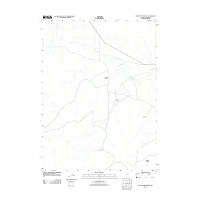
2011 Map of Rye Patch Canyon
USGS Topo · Published 2011About this map
Rye Patch Sheep Camp stands as a focal point of human activity in this arid landscape of Washoe County, indicating the region's enduring ties to livestock ranching and seasonal grazing. The topography is defined by a series of significant drainages and seasonal water sources, including the expansive Duck Flat Wash and the isolated Steer Lake. High-desert canyons such as Rye Patch Canyon, Cedar Canyon, and Smokey Canyon carve through the terrain, while Willow Springs provides a vital point of interest for those tracing historical water availability in the Great Basin. Transportation through this remote area is facilitated by rugged corridors like Buckhorn Rd and Road 28006, which navigate the complex network of canyons and washes that dominate the eastern Nevada borderlands.
Find a feature on this map
10 named features on this map. Tap any name to fly to it.
Don’t see what you’re looking for? This feature index may not catch every label — zoom into the map to look around manually.
Map Details
Editions of this 2011 Rye Patch Canyon Map
This is the sole edition of this map. No revisions or reprints were ever made.
Other maps of this area

1886 · Granite Range
USGS Topo · 1:250,000

1889 · Long Valley
USGS Topo · 1:250,000

1894 · Granite Range
USGS Topo · 1:250,000

1954 · Vya
USGS Topo · 1:250,000

1955 · Lovelock
USGS Topo · 1:250,000

1958 · Vya
USGS Topo · 1:250,000

1959 · Lovelock
USGS Topo · 1:250,000

1962 · Vya
USGS Topo · 1:250,000
1979 · Duck Lake
USGS Topo · 1:24,000
1980 · Burnt Lake
USGS Topo · 1:24,000