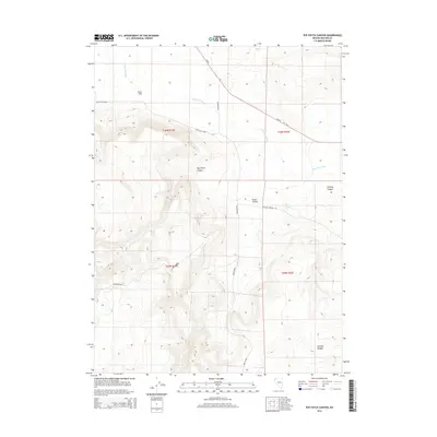
2014 Map of Rye Patch Canyon
USGS Topo · Published 2014About this map
Rye Patch Canyon and the expansive northern basin of Duck Flat define this section of the High Rock Desert region in Washoe County. The landscape is marked by a complex system of drainage and seasonal water sources, including the long reach of Duck Flat Wash and the isolated Steer Lake to the west. Evidence of human movement through this arid environment is recorded in primitive routes like the Duck Lake Loop and Buckhorn Rd, which skirt the edges of deep topographical cuts such as Cedar Canyon and Smokey Canyon. This 2014 survey documents the enduring physical character of the Great Basin, where named locations like Willow Springs represent critical historical landmarks for navigation and survival in a terrain otherwise dominated by the sharp elevation changes of Chicken Canyon.
Find a feature on this map
17 named features on this map. Tap any name to fly to it.
Don’t see what you’re looking for? This feature index may not catch every label — zoom into the map to look around manually.
Map Details
Editions of this 2014 Rye Patch Canyon Map
This is the sole edition of this map. No revisions or reprints were ever made.
Other maps of this area

1886 · Granite Range
USGS Topo · 1:250,000

1889 · Long Valley
USGS Topo · 1:250,000

1894 · Granite Range
USGS Topo · 1:250,000

1954 · Vya
USGS Topo · 1:250,000

1955 · Lovelock
USGS Topo · 1:250,000

1958 · Vya
USGS Topo · 1:250,000

1959 · Lovelock
USGS Topo · 1:250,000

1962 · Vya
USGS Topo · 1:250,000
1979 · Duck Lake
USGS Topo · 1:24,000
1980 · Burnt Lake
USGS Topo · 1:24,000