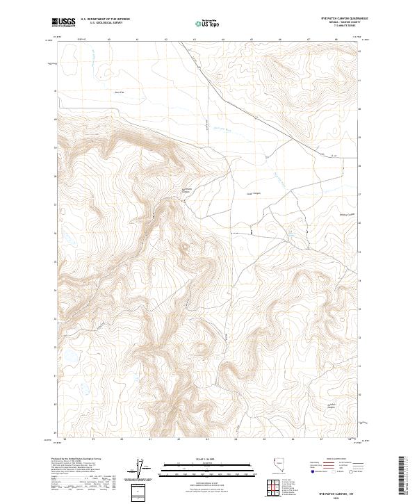
2021 Map of Rye Patch Canyon
USGS Topo · Published 2021About this map
Duck Flat occupies the northern reaches of this High Desert landscape, where the seasonal drainage of Duck Flat Wash cuts through the high plateau. The terrain is defined by a series of deep incisions into the volcanic tablelands, most notably Rye Patch Canyon and Cedar Canyon, which drop sharply from the surrounding ridges. To the east, the topography transitions into Smokey Canyon, while the southern portion of the quadrangle is marked by the winding path of Chicken Canyon.
Find a feature on this map
14 named features on this map. Tap any name to fly to it.
Don’t see what you’re looking for? This feature index may not catch every label — zoom into the map to look around manually.
Map Details
Editions of this 2021 Rye Patch Canyon Map
This is the sole edition of this map. No revisions or reprints were ever made.
Other maps of this area

1886 · Granite Range
USGS Topo · 1:250,000

1889 · Long Valley
USGS Topo · 1:250,000

1894 · Granite Range
USGS Topo · 1:250,000

1954 · Vya
USGS Topo · 1:250,000

1955 · Lovelock
USGS Topo · 1:250,000

1958 · Vya
USGS Topo · 1:250,000

1959 · Lovelock
USGS Topo · 1:250,000

1962 · Vya
USGS Topo · 1:250,000
1979 · Duck Lake
USGS Topo · 1:24,000
1980 · Burnt Lake
USGS Topo · 1:24,000