1981 Map of Rye Patch Canyon
USGS Topo · Published 1981About this map
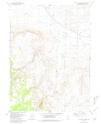
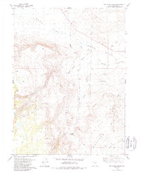
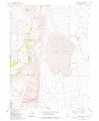
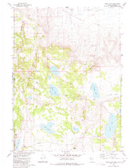
Duck Flat dominates the northern landscape of this Washoe County survey, where the high desert floor gives way to the complex drainage systems of the Buffalo Hills. The area is defined by its seasonal hydrology and livestock history, centered on the Rye Patch Sheep Camp located near the junction of Cedar Canyon and Rye Patch Canyon. These deep corridors, along with Smokey Canyon and Chicken Canyon, provide a detailed look at the water sources that sustained grazing operations in this arid region, such as Willow Springs. The presence of Buckhorn Road and several Borrow Pits indicates the sparse but essential infrastructure required to navigate and maintain this interior rangeland during the early 1980s.
Find a feature on this map
14 named features on this map. Tap any name to fly to it.
Don’t see what you’re looking for? This feature index may not catch every label — zoom into the map to look around manually.
Map Details
Editions of this 1981 Rye Patch Canyon Map
2 editions found
Other maps of this area

1886 · Granite Range
USGS Topo · 1:250,000

1889 · Long Valley
USGS Topo · 1:250,000

1894 · Granite Range
USGS Topo · 1:250,000

1954 · Vya
USGS Topo · 1:250,000

1955 · Lovelock
USGS Topo · 1:250,000

1958 · Vya
USGS Topo · 1:250,000

1959 · Lovelock
USGS Topo · 1:250,000

1962 · Vya
USGS Topo · 1:250,000
1979 · Duck Lake
USGS Topo · 1:24,000
1980 · Burnt Lake
USGS Topo · 1:24,000