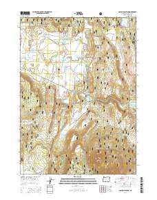
2014 Map of S'Ocholis Canyon
USGS Topo · Published 2014About this map
Winema National Forest dominates this section of the Oregon landscape, where the Sprague River cuts a path through a series of canyons and high volcanic plateaus. The topography is defined by significant elevation changes, rising from the river valley to the heights of Saddle Mtn and the expansive Ya Whee Plateau. Water management is central to the land use here, evidenced by a network of engineered features including Long Prairie Reservoir, Harris Reservoir, and the Quarry Reservoir.
Find a feature on this map
43 named features on this map. Tap any name to fly to it.
Don’t see what you’re looking for? This feature index may not catch every label — zoom into the map to look around manually.
Map Details
Editions of this 2014 S'Ocholis Canyon Map
This is the sole edition of this map. No revisions or reprints were ever made.
Other maps of this area

1889 · Klamath
USGS Topo · 1:250,000

1894 · Klamath
USGS Topo · 1:250,000

1955 · Klamath Falls
USGS Topo · 1:250,000

1956 · Calimus Butte
USGS Topo · 1:62,500

1957 · Chiloquin
USGS Topo · 1:62,500

1957 · Swan Lake
USGS Topo · 1:62,500

1957 · Modoc Point
USGS Topo · 1:62,500

1958 · Klamath Falls
USGS Topo · 1:250,000

1980 · Williamson River
USGS Topo · 1:100,000
1985 · Modoc Point
USGS Topo · 1:24,000