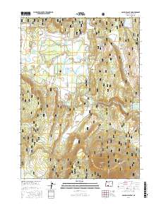
2017 Map of S'Ocholis Canyon
USGS Topo · Published 2017About this map
S'Ocholis Canyon and the high tablelands of the Ya Whee Plateau dominate this 2017 landscape in Klamath County. The topography is defined by a complex network of seasonal water management and natural springs, including Long Prairie Reservoir, Mahogany Ridge Reservoir, and McReady Spring. This modern record reveals a landscape utilized for resource extraction and forestry, evidenced by features like Quarry Reservoir and Borrow Reservoir alongside a grid of specialized access routes like Saddle Mountain Pit Rd and Rollingwood Rd. The map documents a rugged interior where traditional meadowlands like Wrights Meadows meet the distinct flats of No Name Flat and Dockney Flat, while the Sprague River cuts through the canyon floor.
Find a feature on this map
39 named features on this map. Tap any name to fly to it.
Don’t see what you’re looking for? This feature index may not catch every label — zoom into the map to look around manually.
Map Details
Editions of this 2017 S'Ocholis Canyon Map
This is the sole edition of this map. No revisions or reprints were ever made.
Other maps of this area

1889 · Klamath
USGS Topo · 1:250,000

1894 · Klamath
USGS Topo · 1:250,000

1955 · Klamath Falls
USGS Topo · 1:250,000

1956 · Calimus Butte
USGS Topo · 1:62,500

1957 · Chiloquin
USGS Topo · 1:62,500

1957 · Swan Lake
USGS Topo · 1:62,500

1957 · Modoc Point
USGS Topo · 1:62,500

1958 · Klamath Falls
USGS Topo · 1:250,000

1980 · Williamson River
USGS Topo · 1:100,000
1985 · Modoc Point
USGS Topo · 1:24,000