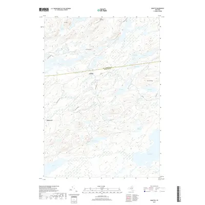
2019 Map of Sabattis
USGS Topo · Published 2019About this map
Adirondack Park dominates this landscape, where the boundary between St. Lawrence and Hamilton counties cuts through a dense network of high-altitude water bodies. The small settlement of Sabattis sits at a junction of local routes, including Co Rd 10 and Charley Pond Rd, serving as a rare point of human habitation in this wilderness. To the west, the location of Robinwood is connected via Robinwood Park Rd, indicating the sparse but deliberate footprint of road development in the region.
Find a feature on this map
32 named features on this map. Tap any name to fly to it.
Don’t see what you’re looking for? This feature index may not catch every label — zoom into the map to look around manually.
Map Details
Editions of this 2019 Sabattis Map
This is the sole edition of this map. No revisions or reprints were ever made.
Other maps of this area

1903 · Big Moose
USGS Topo · 1:62,500

1903 · Raquette Lake
USGS Topo · 1:62,500

1907 · Tupper Lake
USGS Topo · 1:62,500

1919 · Cranberry Lake
USGS Topo · 1:62,500

1921 · Cranberry Lake
USGS Topo · 1:62,500

1931 · Cranberry Lake
USGS Topo · 1:62,500

1948 · Ogdensburg
USGS Topo · 1:250,000

1950 · Utica
USGS Topo · 1:250,000

1951 · Ogdensburg
USGS Topo · 1:250,000

1953 · Ogdensburg
USGS Topo · 1:250,000