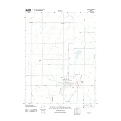
2012 Map of Sabetha
USGS Topo · Published 2012About this map
Sabetha stands at a crossroads of agriculture and aviation in the early twenty-first century, anchored by its grid of streets such as Main St and Oregon St. This survey captures the town's modern infrastructure, including the Sabetha Municipal Airport and the Sabetha Wastewater Treatment Facility, while preserving the locations of its oldest landmarks. To the north and west, the landscape is defined by the rural community of Berwick and a dense network of watercourses including Pony Cr, Deer Cr, and the headwaters of the Delaware River. Genealogists will find significant value in the documentation of several burial sites that reflect the area's pioneer heritage, most notably the Rock Creek Church of the Brethren Cem, the Albany Cem, and the prominent Albany Hill. These sites, along with the Sabetha Cem, serve as primary anchors for tracing family lineages in this corner of Kansas.
Find a feature on this map
64 named features on this map. Tap any name to fly to it.
Don’t see what you’re looking for? This feature index may not catch every label — zoom into the map to look around manually.
Map Details
Editions of this 2012 Sabetha Map
This is the sole edition of this map. No revisions or reprints were ever made.
Other maps of this area

1888 · Hiawatha
USGS Topo · 1:125,000

1894 · Hiawatha
USGS Topo · 1:125,000

1915 · Falls City
USGS Topo · 1:62,500

1916 · Humboldt
USGS Topo · 1:62,500

1950 · Kansas City
USGS Topo · 1:250,000

1954 · Kansas City
USGS Topo · 1:250,000

1955 · Nebraska City
USGS Topo · 1:250,000

1956 · Kansas City
USGS Topo · 1:250,000

1957 · Nebraska City
USGS Topo · 1:250,000

1958 · Nebraska City
USGS Topo · 1:250,000