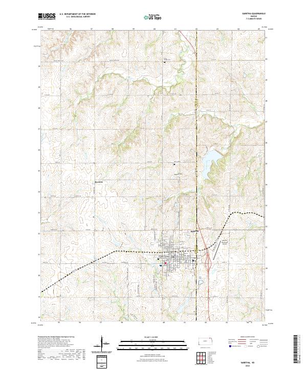
2022 Map of Sabetha
USGS Topo · Published 2022About this map
The Nemaha and Brown County line runs directly through Sabetha, a community defined by its systematic grid of residential streets and its proximity to the Delaware River. The township organization is highly visible, with farm-to-market roads such as 200th Rd and Acorn Rd carving the landscape into predictable square sections. These roads link smaller settlements like Berwick and landforms such as Albany Hill to the regional hub.
Find a feature on this map
90 named features on this map. Tap any name to fly to it.
Don’t see what you’re looking for? This feature index may not catch every label — zoom into the map to look around manually.
Map Details
Editions of this 2022 Sabetha Map
This is the sole edition of this map. No revisions or reprints were ever made.
Other maps of this area

1888 · Hiawatha
USGS Topo · 1:125,000

1894 · Hiawatha
USGS Topo · 1:125,000

1915 · Falls City
USGS Topo · 1:62,500

1916 · Humboldt
USGS Topo · 1:62,500

1950 · Kansas City
USGS Topo · 1:250,000

1954 · Kansas City
USGS Topo · 1:250,000

1955 · Nebraska City
USGS Topo · 1:250,000

1956 · Kansas City
USGS Topo · 1:250,000

1957 · Nebraska City
USGS Topo · 1:250,000

1958 · Nebraska City
USGS Topo · 1:250,000