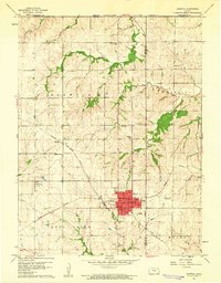
1960 Map of Sabetha
USGS Topo · Published 1961About this map
The town of Sabetha serves as a central hub on this 1960s-era survey, where the Chicago Rock Island and Pacific and Union Pacific railroads intersect. This rail junction shaped the local economy and settlement patterns across the border of Nemaha and Brown counties, supporting the outlying community of Berwick to the northwest. The landscape is dotted with rural educational and commemorative sites, such as the Albany School and the neighboring Albany Cemetery, which reflect the area's pioneer heritage before the consolidation of modern districts.
Find a feature on this map
30 named features on this map. Tap any name to fly to it.
Don’t see what you’re looking for? This feature index may not catch every label — zoom into the map to look around manually.
Map Details
Editions of this 1960 Sabetha Map
This is the sole edition of this map. No revisions or reprints were ever made.
Other maps of this area

1888 · Hiawatha
USGS Topo · 1:125,000

1894 · Hiawatha
USGS Topo · 1:125,000

1915 · Falls City
USGS Topo · 1:62,500

1916 · Humboldt
USGS Topo · 1:62,500

1950 · Kansas City
USGS Topo · 1:250,000

1954 · Kansas City
USGS Topo · 1:250,000

1955 · Nebraska City
USGS Topo · 1:250,000

1956 · Kansas City
USGS Topo · 1:250,000

1957 · Nebraska City
USGS Topo · 1:250,000

1958 · Nebraska City
USGS Topo · 1:250,000