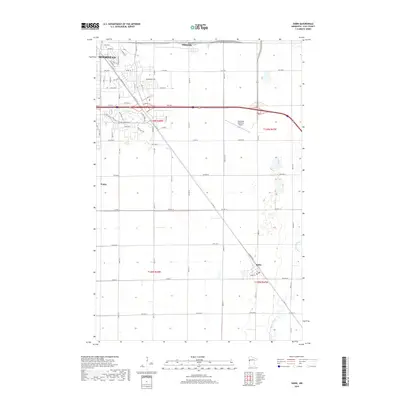
2019 Map of Sabin
USGS Topo · Published 2019About this map
Moorhead and its eastern expansion define the northwestern corner of this Clay County landscape, where the transition from urban streets to broad agricultural tracts is marked by the Moorhead Municipal Airport. Residential developments like those along Village Green Blvd contrast with the long-established rail and road corridors that connect the city to Dilworth and Sabin. The terrain is characterized by a precise grid of county roads and drainage works such as Ditch No 41, which support the intensive farming traditional to this region. In the southeast, the South Branch Buffalo River meanders through the plains, offering a natural break from the geometric section lines that organize the surrounding townships. Smaller named localities like Finkle highlight the scattered nature of rural crossroads that once served as vital links in the local agricultural economy.
Find a feature on this map
48 named features on this map. Tap any name to fly to it.
Don’t see what you’re looking for? This feature index may not catch every label — zoom into the map to look around manually.
Map Details
Editions of this 2019 Sabin Map
This is the sole edition of this map. No revisions or reprints were ever made.
Other maps of this area

1895 · Fargo
USGS Topo · 1:125,000

1897 · Fargo
USGS Topo · 1:125,000

1953 · Fargo
USGS Topo · 1:250,000

1956 · Fargo
USGS Topo · 1:250,000

1959 · Fargo North
USGS Topo · 1:24,000

1959 · Fargo South
USGS Topo · 1:24,000

1959 · Hickson
USGS Topo · 1:24,000

1964 · Sabin
USGS Topo · 1:24,000

1964 · Baker
USGS Topo · 1:24,000

1964 · Dilworth
USGS Topo · 1:24,000