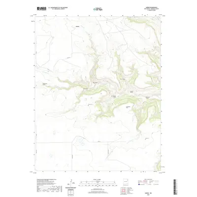
2020 Map of Sabino
USGS Topo · Published 2020About this map
Sabino sits at the northern edge of this high-plains landscape, where the plateau is deeply incised by the drainage systems of Sabino Cr and Tequesquite Cr. The terrain is defined by dramatic changes in elevation between the flat surface of Circle S Mesa and the branching ravines of Vigil Canyon and Graybill Canyon. This 2020 survey reveals a quiet, ranching-oriented region in Harding County, where a handful of maintained roads like Sabino Rd and Lewis Rd connect isolated homesteads and family landmarks.
Find a feature on this map
29 named features on this map. Tap any name to fly to it.
Don’t see what you’re looking for? This feature index may not catch every label — zoom into the map to look around manually.
Map Details
Editions of this 2020 Sabino Map
This is the sole edition of this map. No revisions or reprints were ever made.
Other maps of this area

1954 · Santa Fe
USGS Topo · 1:250,000

1954 · Raton
USGS Topo · 1:250,000

1954 · Tucumcari
USGS Topo · 1:250,000

1954 · Dalhart
USGS Topo · 1:250,000

1958 · Raton
USGS Topo · 1:250,000

1958 · Santa Fe
USGS Topo · 1:250,000

1958 · Tucumcari
USGS Topo · 1:250,000

1958 · Dalhart
USGS Topo · 1:250,000

1962 · Dalhart
USGS Topo · 1:250,000

1973 · Yates SE
USGS Topo · 1:24,000