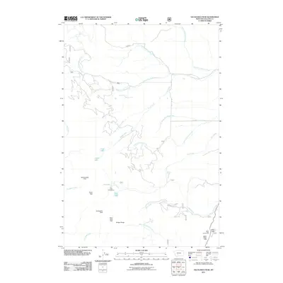
2011 Map of Sacagawea Peak
USGS Topo · Published 2011About this map
Sacagawea Peak and the high elevations of the Bridger Range dominate this 2011 survey, marking the jagged skyline of Gallatin County. This alpine landscape is defined by its collection of notable summits, including Hardscrabble Peak, Pomp Peak, and Naya Nuki Peak. The map highlights a network of mountain drainage systems, where the headwaters of Fairy Creek, Frazier Creek, and Cache Creek descend toward the valleys below. Recreational points of interest are anchored by the Fairy Lake Campground near the pristine Fairy Lake and Elf Lake, while Battle Ridge Campground sits further southeast near Battle Ridge Pass. In the northern section, the terrain transitions into a web of tributaries such as the North Fork, Middle Fork, and South Fork of Flathead Creek, illustrating the complex hydrology of this high-country environment.
Find a feature on this map
32 named features on this map. Tap any name to fly to it.
Don’t see what you’re looking for? This feature index may not catch every label — zoom into the map to look around manually.
Map Details
Editions of this 2011 Sacagawea Peak Map
This is the sole edition of this map. No revisions or reprints were ever made.
Other maps of this area

1886 · Fort Logan
USGS Topo · 1:250,000

1886 · Little Belt Mts.
USGS Topo · 1:250,000

1888 · Three Forks
USGS Topo · 1:250,000

1891 · Livingston
USGS Topo · 1:250,000

1893 · Livingston
USGS Topo · 1:250,000

1894 · Three Forks
USGS Topo · 1:250,000

1894 · Little Belt Mts.
USGS Topo · 1:250,000

1895 · Three Forks
USGS Topo · 1:250,000

1897 · Little Belt Mts.
USGS Topo · 1:250,000

1898 · Little Belt Mts.
USGS Topo · 1:250,000