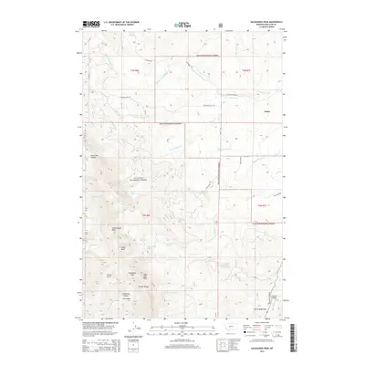
2014 Map of Sacagawea Peak
USGS Topo · Published 2014About this map
Sacagawea Peak and the surrounding Bridger Range dominate this 2014 survey of north-central Gallatin County. High-altitude hydrology is a defining characteristic, with several alpine water bodies including Fairy Lake, Elf Lake, Ainger Lake, and Frazier Lake clustered near the summits. The settlement of Sedan serves as the primary landmark in the eastern flats, positioned near where the N Fork Flathead Cr and Flathead Cr emerge from the mountains. The terrain is deeply incised by drainages such as Corbly Gulch, Limestone Canyon, and Dry Canyon, which reveal the complex topography of the Gallatin National Forest. Transportation through this steep landscape is limited to specific corridors like Flathead Pass Rd and Battle Ridge Pass, illustrating the geographic constraints on local travel during the early 21st century.
Find a feature on this map
46 named features on this map. Tap any name to fly to it.
Don’t see what you’re looking for? This feature index may not catch every label — zoom into the map to look around manually.
Map Details
Editions of this 2014 Sacagawea Peak Map
This is the sole edition of this map. No revisions or reprints were ever made.
Other maps of this area

1886 · Fort Logan
USGS Topo · 1:250,000

1886 · Little Belt Mts.
USGS Topo · 1:250,000

1888 · Three Forks
USGS Topo · 1:250,000

1891 · Livingston
USGS Topo · 1:250,000

1893 · Livingston
USGS Topo · 1:250,000

1894 · Three Forks
USGS Topo · 1:250,000

1894 · Little Belt Mts.
USGS Topo · 1:250,000

1895 · Three Forks
USGS Topo · 1:250,000

1897 · Little Belt Mts.
USGS Topo · 1:250,000

1898 · Little Belt Mts.
USGS Topo · 1:250,000