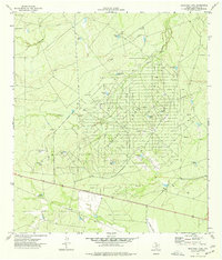
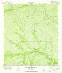
1974 Map of Sacatosa Tank
USGS Topo · Published 1977About this map
Sacatosa Field and the surrounding Maverick County rangeland define this mid-1970s landscape, illustrating the intensive infrastructure of the Texas oil and gas industry. The area is marked by a high density of Oil Wells, a central Gasoline Plant, and an extensive Pipeline network that crisscrosses the scrubland. Water management is the other primary human imprint on this arid terrain; dozens of man-made catchments like Sacatosa Tank, San Pablo Tank, and Comanche Tank are distributed along the drainages of Chueco Creek and Chimeneas Creek. This distribution of "tanks" suggests a land use dedicated to cattle ranching alongside energy extraction. The map also reveals localized logistical points such as a remote Landing Strip and an electrical Substa, providing a clear look at the industrial operations required to maintain production in this part of South Texas.
Find a feature on this map
25 named features on this map. Tap any name to fly to it.
Don’t see what you’re looking for? This feature index may not catch every label — zoom into the map to look around manually.
Map Details
Editions of this 1974 Sacatosa Tank Map
This is the sole edition of this map. No revisions or reprints were ever made.
Other maps of this area

1940 · Cometa
USGS Topo · 1:62,500

1940 · Eagle Pass
USGS Topo · 1:62,500

1940 · Paloma
USGS Topo · 1:62,500

1940 · Chacon Creek
USGS Topo · 1:62,500

1958 · Eagle Pass
USGS Topo · 1:250,000

1965 · Eagle Pass
USGS Topo · 1:250,000
1974 · Cometa
USGS Topo · 1:24,000
1974 · Indian Tank
USGS Topo · 1:24,000
1974 · Chacon Creek SE
USGS Topo · 1:24,000
1974 · Chacon Creek SW
USGS Topo · 1:24,000