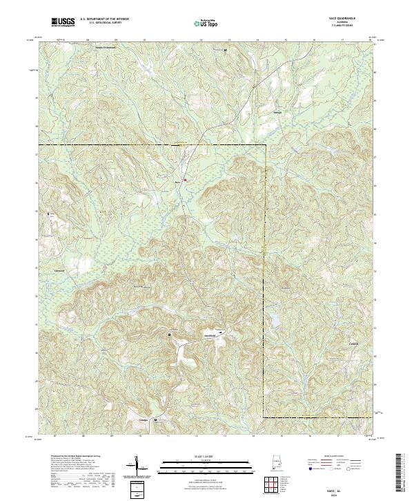
2024 Map of Saco
USGS Topo · Published 2024About this map
The Conecuh River winds through the rural landscape of Pike and Bullock Counties, defining a region characterized by small agricultural settlements and family burial grounds. High ground is marked by distinctive formations like the Devils Backbone and Wolfpit Hill, while numerous small watercourses including Buck Creek and Mill Creek drain the surrounding countryside. This contemporary survey preserves the locations of vital community centers such as Beans Crossroads and Saco, alongside rural crossroads like Sandfield and Linwood. Genealogists will find particular value in the documentation of local resting places, from the Old Canaan Cem and Sandfield Cem to the Barnette Cem near the northern boundary. The road network, composed of routes like Co RD 15 and Co RD 48, links these scattered homesteads and legacy landmarks, reflecting a deep-rooted rural settlement pattern that persists into the present day.
Find a feature on this map
68 named features on this map. Tap any name to fly to it.
Don’t see what you’re looking for? This feature index may not catch every label — zoom into the map to look around manually.
Map Details
Editions of this 2024 Saco Map
This is the sole edition of this map. No revisions or reprints were ever made.
Other maps of this area

1953 · Dothan
USGS Topo · 1:250,000

1954 · Dothan
USGS Topo · 1:250,000

1955 · Dothan
USGS Topo · 1:250,000

1955 · Phenix City
USGS Topo · 1:250,000

1957 · Phenix City
USGS Topo · 1:250,000

1958 · Phenix City
USGS Topo · 1:250,000

1968 · Perote
USGS Topo · 1:24,000
1968 · Saco
USGS Topo · 1:24,000
1968 · Josie
USGS Topo · 1:24,000
1968 · Troy
USGS Topo · 1:24,000