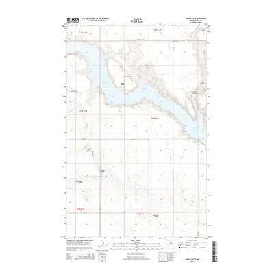
2014 Map of Saddle Butte
USGS Topo · Published 2014About this map
Fresno Reservoir dominates this northern Montana landscape, created by the damming of the Milk River. The map details the intricate drainage network of the high plains, where numerous erosional features like Watson Coulee and Cottonwood Coulee carve into the surrounding plateau. The eponymous Saddle Butte rises as a distinct landmark overlooking the reservoir's northern reaches. Further south, the terrain transitions into a string of depressions including the Alkali Lakes, Chain-of-Lakes, and Dry Lake Coulee. This 2014 survey documents the modern road grid that services this rural portion of Hill County, featuring primary routes such as Kremlin Rd and Chain Lake Rd. The layout of section lines and range boundaries provides a clear framework for understanding the region's agricultural and land management history in the early 21st century.
Find a feature on this map
24 named features on this map. Tap any name to fly to it.
Don’t see what you’re looking for? This feature index may not catch every label — zoom into the map to look around manually.
Map Details
Editions of this 2014 Saddle Butte Map
This is the sole edition of this map. No revisions or reprints were ever made.
Other maps of this area

1904 · Assinniboine
USGS Topo · 1:62,500

1906 · Kremlin
USGS Topo · 1:62,500

1912 · Thibedeau Lake
USGS Topo · 1:125,000

1920 · Gildford
USGS Topo · 1:125,000

1943 · Gildford
USGS Topo · 1:125,000

1953 · Havre
USGS Topo · 1:250,000

1954 · Shelby
USGS Topo · 1:250,000

1957 · Havre
USGS Topo · 1:250,000

1958 · Shelby
USGS Topo · 1:250,000

1958 · Havre
USGS Topo · 1:250,000