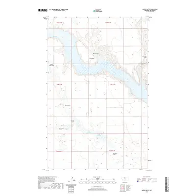
2020 Map of Saddle Butte
USGS Topo · Published 2020About this map
Fresno Reservoir and the Milk River dominate the northern terrain of this Hill County landscape, where the water is hemmed in by a complex network of erosional features. The terrain is defined by its coulees—steep-walled drainage valleys—including Watson Coulee, Cottonwood Coulee, and Wild Rose Coulee. These geographical signatures indicate a dry environment where seasonal runoff has carved deeply into the high plains over millennia. Centrally located, Saddle Butte rises as a prominent landmark above the surrounding flats. To the south, the Chain of Lakes and Alkali Lakes suggest internal drainage basins common to the northern glaciated plains, with labels like Dry Lake Coulee and Alkali Lakes Coulee pointing toward the mineral-heavy, ephemeral nature of the water sources in this part of Montana.
Find a feature on this map
19 named features on this map. Tap any name to fly to it.
Don’t see what you’re looking for? This feature index may not catch every label — zoom into the map to look around manually.
Map Details
Editions of this 2020 Saddle Butte Map
This is the sole edition of this map. No revisions or reprints were ever made.
Other maps of this area

1904 · Assinniboine
USGS Topo · 1:62,500

1906 · Kremlin
USGS Topo · 1:62,500

1912 · Thibedeau Lake
USGS Topo · 1:125,000

1920 · Gildford
USGS Topo · 1:125,000

1943 · Gildford
USGS Topo · 1:125,000

1953 · Havre
USGS Topo · 1:250,000

1954 · Shelby
USGS Topo · 1:250,000

1957 · Havre
USGS Topo · 1:250,000

1958 · Shelby
USGS Topo · 1:250,000

1958 · Havre
USGS Topo · 1:250,000