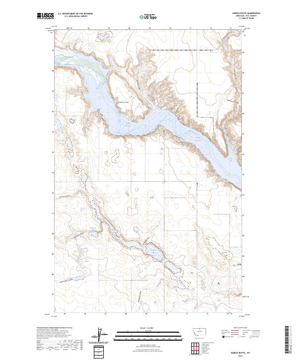
2024 Map of Saddle Butte
USGS Topo · Published 2024About this map
Saddle Butte rises above a northern Montana landscape dominated by the winding path of the Milk River and the expansive waters of the Fresno Reservoir. This modern topographic study reveals a complex system of drainage channels, or coulees, that define the terrain of Hill County. The reservoir itself occupies a significant portion of the north-central area, its jagged shoreline shaped by the inundation of numerous smaller valleys like Watson Coulee and Cottonwood Coulee. To the south, a distinctive series of water bodies known as the Chain of Lakes stretches across the plains, connected by the Chain of Lakes Coulee. The map provides a clear look at the hydraulic patterns and land divisions within the Public Land Survey System, including sections of t34n r13e and t35n r12e, illustrating how water management and natural topography dictate the modern rural character of the region.
Find a feature on this map
18 named features on this map. Tap any name to fly to it.
Don’t see what you’re looking for? This feature index may not catch every label — zoom into the map to look around manually.
Map Details
Editions of this 2024 Saddle Butte Map
This is the sole edition of this map. No revisions or reprints were ever made.
Other maps of this area

1904 · Assinniboine
USGS Topo · 1:62,500

1906 · Kremlin
USGS Topo · 1:62,500

1912 · Thibedeau Lake
USGS Topo · 1:125,000

1920 · Gildford
USGS Topo · 1:125,000

1943 · Gildford
USGS Topo · 1:125,000

1953 · Havre
USGS Topo · 1:250,000

1954 · Shelby
USGS Topo · 1:250,000

1957 · Havre
USGS Topo · 1:250,000

1958 · Shelby
USGS Topo · 1:250,000

1958 · Havre
USGS Topo · 1:250,000