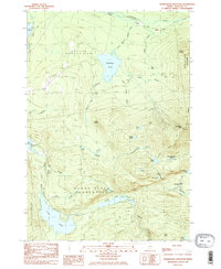
1985 Map of Saddleback Mountain
USGS Topo · Published 1985About this map
Dallas Plantation and Sandy River Plantation define this landscape of the High Peaks region, centered on the prominence of Saddleback Mtn. The 1985 survey captures the area during a period of recreational development, highlighting the Ski Area and the winding path of the Appalachian Trail as it traverses the ridgeline. Water dominates the lower elevations, from the expansive Saddleback Lake to the chain of Sandy River Ponds and the deep waters of Long Pond. Evidence of the region’s timber and transport history remains visible through the Old RR Grade running near Gull Pond, while smaller settlements like Dallas and points like Greenvale Cove mark the light human footprint on this high-elevation terrain. This map serves as an essential record for tracing the balance between the historic logging infrastructure and the emergence of modern wilderness recreation.
Find a feature on this map
44 named features on this map. Tap any name to fly to it.
Don’t see what you’re looking for? This feature index may not catch every label — zoom into the map to look around manually.
Map Details
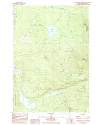
Editions of this 1985 Saddleback Mountain Map
2 editions found
Other maps of this area

1928 · Stratton
USGS Topo · 1:48,000

1929 · Phillips
USGS Topo · 1:48,000

1932 · Phillips
USGS Topo · 1:62,500

1932 · Stratton
USGS Topo · 1:62,500

1932 · Kennebago Lake
USGS Topo · 1:48,000

1933 · Rangeley
USGS Topo · 1:48,000

1935 · Kennebago Lake
USGS Topo · 1:62,500

1936 · Kennebago Lake
USGS Topo · 1:62,500

1939 · Rangeley
USGS Topo · 1:62,500

1949 · Jackman
USGS Topo · 1:250,000
Featured Places
- Dallas Plantation, ME
- Rangeley Plantation, ME
- Madrid Township, ME
- Sandy River Plantation, ME
- Redington Township, ME