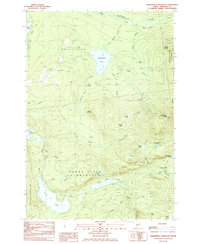
1985 Map of Saddleback Mountain
USGS Topo · Published 1985About this map
Dallas Plantation and Sandy River Plantation define this pocket of the western Maine mountains in the mid-1980s. The landscape is dominated by the high peaks of Saddleback Mtn and Potato Nubble, with the Appalachian Trail winding through the high country. Evidence of earlier industry is visible in the north, where an Old RR Grade follows the topography near the South Branch Dead River.
Find a feature on this map
42 named features on this map. Tap any name to fly to it.
Don’t see what you’re looking for? This feature index may not catch every label — zoom into the map to look around manually.
Map Details
Editions of this 1985 Saddleback Mountain Map
2 editions found
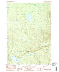
Other maps of this area

1928 · Stratton
USGS Topo · 1:48,000

1929 · Phillips
USGS Topo · 1:48,000

1932 · Phillips
USGS Topo · 1:62,500

1932 · Stratton
USGS Topo · 1:62,500

1932 · Kennebago Lake
USGS Topo · 1:48,000

1933 · Rangeley
USGS Topo · 1:48,000

1935 · Kennebago Lake
USGS Topo · 1:62,500

1936 · Kennebago Lake
USGS Topo · 1:62,500

1939 · Rangeley
USGS Topo · 1:62,500

1949 · Jackman
USGS Topo · 1:250,000
Featured Places
- Dallas Plantation, ME
- Rangeley Plantation, ME
- Madrid Township, ME
- Sandy River Plantation, ME
- Redington Township, ME