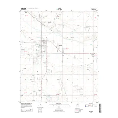
2014 Map of Safford
USGS Topo · Published 2014About this map
The Gila River corridor serves as the primary artery through this Graham County landscape, supporting a complex irrigation network vital to the Gila Valley. Historic water management is evident in the paths of the Sunflower Canal, Montezuma Canal, and Union Canal, which divert water to sustain agriculture around Safford and Thatcher. This system of canals and washes, including Dry Lake Wash and Graveyard Wash, illustrates the long-standing reliance on hydraulic engineering in the Arizona desert.
Find a feature on this map
125 named features on this map. Tap any name to fly to it.
Don’t see what you’re looking for? This feature index may not catch every label — zoom into the map to look around manually.
Map Details
Editions of this 2014 Safford Map
This is the sole edition of this map. No revisions or reprints were ever made.
Other maps of this area

1942 · Mt. Graham
USGS Topo · 1:62,500

1945 · Mt. Graham
USGS Topo · 1:62,500

1954 · Silver City
USGS Topo · 1:250,000

1958 · Silver City
USGS Topo · 1:250,000

1960 · Thatcher
USGS Topo · 1:62,500

1960 · Safford
USGS Topo · 1:62,500

1962 · Silver City
USGS Topo · 1:250,000
1966 · Artesia NE
USGS Topo · 1:24,000

1966 · Artesia
USGS Topo · 1:24,000
1972 · Mt. Graham
USGS Topo · 1:24,000