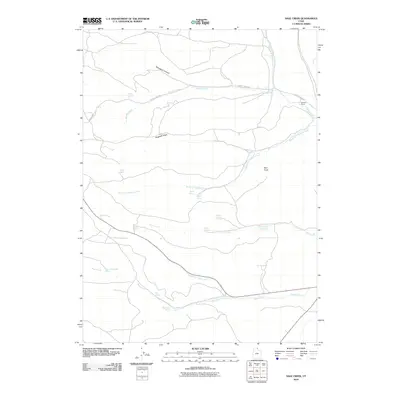
2010 Map of Sage Creek
USGS Topo · Published 2010About this map
Sixmile Ranch sits at the junction of several drainage systems in this northern Utah landscape, where water dictates the location of both travel routes and human settlement. The territory is defined by the high relief of Hogback Ridge and Red Knoll, with water sources like Rabbit Spring and Divide Spring providing essential resources in an otherwise arid environment. Along Sixmile Creek Rd, the terrain transitions into deeper cuts like Mahogany Canyon, illustrating the erosive power of the seasonal and perennial flows that feed into Sixmile Creek and Sage Creek. The concentration of named water points, including Barrel Spring and Rich Spring, suggests a landscape heavily managed for ranching and livestock movement. These features provide a clear look at the hydraulic infrastructure supporting the remote agricultural operations near the Idaho border during the early 21st century.
Find a feature on this map
22 named features on this map. Tap any name to fly to it.
Don’t see what you’re looking for? This feature index may not catch every label — zoom into the map to look around manually.
Map Details
Editions of this 2010 Sage Creek Map
This is the sole edition of this map. No revisions or reprints were ever made.
Other maps of this area

1912 · Randolph
USGS Topo · 1:125,000

1954 · Ogden
USGS Topo · 1:250,000

1958 · Ogden
USGS Topo · 1:250,000

1960 · Ogden
USGS Topo · 1:250,000

1968 · Rex Peak
USGS Topo · 1:24,000

1968 · Randolph
USGS Topo · 1:24,000

1969 · Sheeppen Creek
USGS Topo · 1:24,000
1969 · Leefe
USGS Topo · 1:24,000
1969 · South Lake
USGS Topo · 1:24,000
1969 · Bear Lake South
USGS Topo · 1:24,000