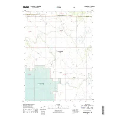
2018 Map of Sagebrush Butte
USGS Topo · Published 2018About this map
Lost River winds across the high desert terrain of the Oregon California border in this study of the Klamath Basin backcountry. The landscape is defined by its vital water sources and vast conservation areas, including the northern reaches of the Modoc National Forest and the Clear Lake National Wildlife Refuge. The map reveals the intricate hydrology of the region, featuring the large expanse of the Clear Lake Reservoir and smaller features like Mammoth Springs and Willow Valley Reservoir. Landforms such as Sagebrush Butte and Carr Butte provide significant vertical relief above the flats of Wilson Valley. This 2018 survey captures a remote frontier where state lines meet at Klamath and Modoc counties, documenting a region dominated by wildlife habitat and high-elevation springs.
Find a feature on this map
26 named features on this map. Tap any name to fly to it.
Don’t see what you’re looking for? This feature index may not catch every label — zoom into the map to look around manually.
Map Details
Editions of this 2018 Sagebrush Butte Map
This is the sole edition of this map. No revisions or reprints were ever made.
Other maps of this area

1886 · Alturas
USGS Topo · 1:250,000

1886 · Modoc Lava Bed
USGS Topo · 1:250,000

1889 · Klamath
USGS Topo · 1:250,000

1892 · Modoc Lava-Bed
USGS Topo · 1:250,000

1892 · Alturas
USGS Topo · 1:250,000

1894 · Klamath
USGS Topo · 1:250,000

1951 · Clear Lake Reservoir
USGS Topo · 1:62,500

1954 · Alturas
USGS Topo · 1:250,000

1955 · Klamath Falls
USGS Topo · 1:250,000

1958 · Alturas
USGS Topo · 1:250,000