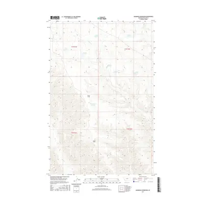
2017 Map of Sagebrush Reservoir
USGS Topo · Published 2017About this map
Wilder Ridge dominates the central landscape of this Phillips County terrain, where a sophisticated network of small-scale water management features defines the rural character. In this 2017 study, the repetition of named catchments like Sagebrush Reservoir, Gullwing Reservoir, and Manning Corral Reservoir suggests a geography deeply tied to livestock ranching and arid-land survival. These reservoirs are often situated at the headwaters or along the winding courses of intermittent drainages such as Sevenmile Cr and Rock Cr. The terrain is further etched by features like Wilder Coulee, illustrating a deeply eroded landscape where every depression has been utilized for water storage. The nomenclature, featuring names like Whiteface Reservoir and Paleface Reservoir, reflects a local vernacular rooted in the land's utility and the visual markers of the high plains.
Find a feature on this map
17 named features on this map. Tap any name to fly to it.
Don’t see what you’re looking for? This feature index may not catch every label — zoom into the map to look around manually.
Map Details
Editions of this 2017 Sagebrush Reservoir Map
This is the sole edition of this map. No revisions or reprints were ever made.
Other maps of this area

1943 · Landusky
USGS Topo · 1:125,000

1954 · Bell Ridge East
USGS Topo · 1:24,000

1954 · Carter Coulee
USGS Topo · 1:24,000

1954 · Lewistown
USGS Topo · 1:250,000

1959 · Lewistown
USGS Topo · 1:250,000

1971 · Robinson School
USGS Topo · 1:24,000

1971 · Hays SE
USGS Topo · 1:24,000

1971 · Bison Bone Reservoir
USGS Topo · 1:24,000

1971 · Blizzard Reservoir
USGS Topo · 1:24,000

1971 · Kepple Bottoms
USGS Topo · 1:24,000