
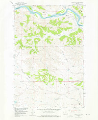
1954 Map of Carter Coulee
USGS Topo · Published 1956About this map
The Missouri River defines the northern boundary of this central Montana landscape, where extensive alluvial flats like White Bottoms and Bell Bottoms separate the water from the rising breaks. Much of the northern terrain is occupied by the Fort Peck Game Range, a testament to the mid-century conservation efforts in the Missouri River Basin. In the southern portion of the map, the Little Crooked Creek Sch (Aband) and an Old Trail suggest a more active period of homesteading and early cattle ranching that once centered around remote outposts like the Mathison Ranch and Roma White Ranch. The topography is a complex network of drainage systems, including Carter Coulee and Fritzner Coulee, which cut through the high plains toward the river valley. Landmarks such as Button Butte and Smoky Johnson Hill provide essential navigational points in this sparsely populated region of Phillips and Fergus Counties.
Find a feature on this map
36 named features on this map. Tap any name to fly to it.
Don’t see what you’re looking for? This feature index may not catch every label — zoom into the map to look around manually.
Map Details
Editions of this 1954 Carter Coulee Map
2 editions found
Other maps of this area

1943 · Landusky
USGS Topo · 1:125,000

1954 · Bell Ridge East
USGS Topo · 1:24,000

1954 · Hessler Ridge
USGS Topo · 1:24,000

1954 · Bell Ridge West
USGS Topo · 1:24,000

1954 · Lewistown
USGS Topo · 1:250,000

1959 · Lewistown
USGS Topo · 1:250,000

1971 · Kepple Bottoms
USGS Topo · 1:24,000
1971 · Sagebrush Reservoir
USGS Topo · 1:24,000

1984 · Zortman
USGS Topo · 1:100,000

1985 · Sloan Reservoir
USGS Topo · 1:24,000