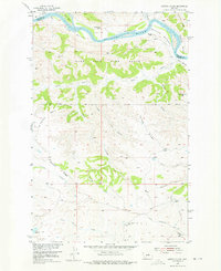
1954 Map of Carter Coulee
USGS Topo · Published 1976About this map
The Missouri River dominates the northern reaches of this mid-century survey, flanked by a series of alluvial flats including White Bottoms, Mauland Bottoms, and Doney Bottoms. These lowlands transitioned quickly into the protected lands of the Fort Peck Game Range, a landscape defined by an intricate network of coulees and ridges. Ranching life is documented through established sites like the Roma White Ranch and Mauland Ranch near the river, while the presence of the Little Crooked Creek Sch (Aband) further south suggests an earlier era of rural community that had already begun to fade by the 1950s.
Find a feature on this map
32 named features on this map. Tap any name to fly to it.
Don’t see what you’re looking for? This feature index may not catch every label — zoom into the map to look around manually.
Map Details
Editions of this 1954 Carter Coulee Map
2 editions found
Other maps of this area

1943 · Landusky
USGS Topo · 1:125,000

1954 · Bell Ridge East
USGS Topo · 1:24,000

1954 · Hessler Ridge
USGS Topo · 1:24,000

1954 · Carter Coulee
USGS Topo · 1:24,000

1954 · Bell Ridge West
USGS Topo · 1:24,000

1954 · Lewistown
USGS Topo · 1:250,000

1959 · Lewistown
USGS Topo · 1:250,000

1971 · Kepple Bottoms
USGS Topo · 1:24,000
1971 · Sagebrush Reservoir
USGS Topo · 1:24,000

1984 · Zortman
USGS Topo · 1:100,000