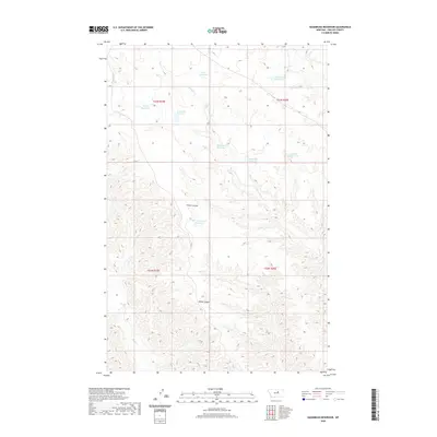
2020 Map of Sagebrush Reservoir
USGS Topo · Published 2020About this map
Sagebrush Reservoir sits in the heart of this Phillips County landscape, a terrain defined by a network of essential water catchments in a vast open range. The drainage of Sevenmile Cr and Rock Cr thread through the complex topography of Wilder Ridge and Wilder Coulee, highlighting the seasonal water management critical to this part of Montana. Named reservoirs like Manning Corral Reservoir, Gullwing Reservoir, and Whiteface Reservoir are scattered across the township lines of T23N and T22N, suggesting a history of land use focused on livestock and resource preservation. The sparse naming of these water bodies against the physical features of the coulees provides a clear view of the ranching infrastructure and geography as it existed in the early 21st century.
Find a feature on this map
17 named features on this map. Tap any name to fly to it.
Don’t see what you’re looking for? This feature index may not catch every label — zoom into the map to look around manually.
Map Details
Editions of this 2020 Sagebrush Reservoir Map
This is the sole edition of this map. No revisions or reprints were ever made.
Other maps of this area

1943 · Landusky
USGS Topo · 1:125,000

1954 · Bell Ridge East
USGS Topo · 1:24,000

1954 · Carter Coulee
USGS Topo · 1:24,000

1954 · Lewistown
USGS Topo · 1:250,000

1959 · Lewistown
USGS Topo · 1:250,000

1971 · Robinson School
USGS Topo · 1:24,000

1971 · Hays SE
USGS Topo · 1:24,000

1971 · Bison Bone Reservoir
USGS Topo · 1:24,000

1971 · Blizzard Reservoir
USGS Topo · 1:24,000

1971 · Kepple Bottoms
USGS Topo · 1:24,000