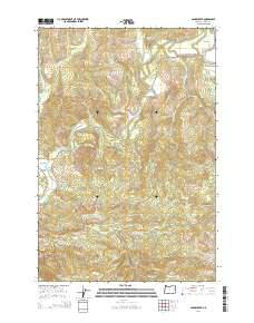
2014 Map of Sager Creek
USGS Topo · Published 2014About this map
The settlement of Jewell serves as the focal point of this Northwest Oregon landscape, situated where the Fish Hawk Falls Hwy meets the winding Nehalem River. This 2014 survey reveals a territory defined by its complex drainage systems and timbered heights, with the Nehalem Valley cutting through the northern reaches. The terrain is marked by a network of resource roads like Squaw Ridge Rd and Green Mountain Lookout Rd, which provides access to the higher elevations of Green Mountain in the south. Dozens of small waterways, including Buster Cr and Lousignont Cr, carve through the ridges, illustrating the heavy precipitation and dense hydraulic network characteristic of the Coast Range. Researchers will find numerous named family landmarks and local roads such as Boeck Ranch Rd and Cahill Rd that indicate the rural heritage and land use patterns of this Clatsop County region.
Find a feature on this map
39 named features on this map. Tap any name to fly to it.
Don’t see what you’re looking for? This feature index may not catch every label — zoom into the map to look around manually.
Map Details
Editions of this 2014 Sager Creek Map
This is the sole edition of this map. No revisions or reprints were ever made.
Other maps of this area

1939 · Saddle Mountain
USGS Topo · 1:62,500

1940 · Svensen
USGS Topo · 1:62,500

1941 · Keasey
USGS Topo · 1:62,500

1941 · Cathlamet
USGS Topo · 1:62,500

1943 · Keasey
USGS Topo · 1:62,500

1943 · Saddle Mtn.
USGS Topo · 1:62,500

1948 · Vancouver
USGS Topo · 1:250,000

1950 · Vancouver
USGS Topo · 1:250,000

1950 · Vancouver
USGS Topo · 1:250,000

1953 · Hoquiam
USGS Topo · 1:250,000