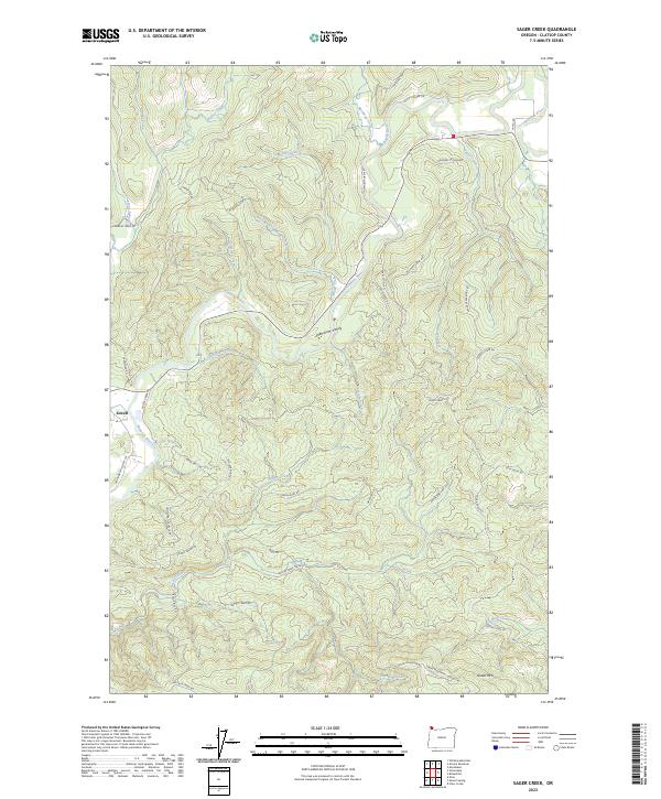
2023 Map of Sager Creek
USGS Topo · Published 2023About this map
Jewell serves as the primary settlement on this map, situated where the Nehalem River winds through the prominent Nehalem Valley. The landscape is defined by an intricate network of waterways draining the timbered uplands of Clatsop County, including Walker Creek, Buster Creek, and Sager Creek. In the southern portion of the quadrangle, Green Mtn rises above Stanley Creek, while the Nehalem Crossover and Fishhawk Falls Hwy 103 facilitate transit through this demanding terrain. The map's layout of timber roads, such as Buster Creek Mainline and Sager Creek Ridge Rd, illustrates the intensive forestry operations and resource management that characterize the region. For researchers, these local roads often follow historical logging grades or property boundaries established during the early settlement of the Oregon Coast Range.
Find a feature on this map
50 named features on this map. Tap any name to fly to it.
Don’t see what you’re looking for? This feature index may not catch every label — zoom into the map to look around manually.
Map Details
Editions of this 2023 Sager Creek Map
This is the sole edition of this map. No revisions or reprints were ever made.
Other maps of this area

1939 · Saddle Mountain
USGS Topo · 1:62,500

1940 · Svensen
USGS Topo · 1:62,500

1941 · Keasey
USGS Topo · 1:62,500

1941 · Cathlamet
USGS Topo · 1:62,500

1943 · Keasey
USGS Topo · 1:62,500

1943 · Saddle Mtn.
USGS Topo · 1:62,500

1948 · Vancouver
USGS Topo · 1:250,000

1950 · Vancouver
USGS Topo · 1:250,000

1950 · Vancouver
USGS Topo · 1:250,000

1953 · Hoquiam
USGS Topo · 1:250,000