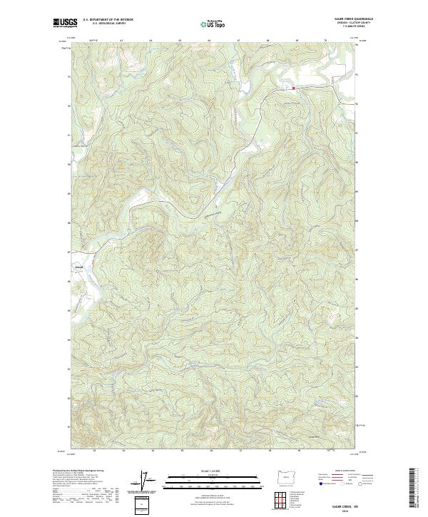
2024 Map of Sager Creek
USGS Topo · Published 2024About this map
Jewell serves as the primary node of settlement in this part of the Nehalem Valley, situated where the Fishhawk Falls Hwy 103 crosses the Nehalem River. The landscape is defined by the winding course of the river and its numerous tributaries, including Slaughters Creek and Northrup Creek, which carve through the timber-heavy terrain of the Oregon Coast Range. To the south, Green Mtn rises above a network of forest roads and logging spurs.
Find a feature on this map
52 named features on this map. Tap any name to fly to it.
Don’t see what you’re looking for? This feature index may not catch every label — zoom into the map to look around manually.
Map Details
Editions of this 2024 Sager Creek Map
This is the sole edition of this map. No revisions or reprints were ever made.
Other maps of this area

1939 · Saddle Mountain
USGS Topo · 1:62,500

1940 · Svensen
USGS Topo · 1:62,500

1941 · Keasey
USGS Topo · 1:62,500

1941 · Cathlamet
USGS Topo · 1:62,500

1943 · Keasey
USGS Topo · 1:62,500

1943 · Saddle Mtn.
USGS Topo · 1:62,500

1948 · Vancouver
USGS Topo · 1:250,000

1950 · Vancouver
USGS Topo · 1:250,000

1950 · Vancouver
USGS Topo · 1:250,000

1953 · Hoquiam
USGS Topo · 1:250,000