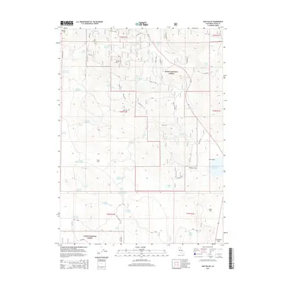
2015 Map of Said Valley
USGS Topo · Published 2015About this map
Said Valley serves as a central landmark in this high-elevation landscape within the Modoc National Forest and Lassen National Forest. The map reveals a sophisticated network of water management, evidenced by numerous man-made catchments like Said Valley Reservoir, Hazelton Reservoir, and Hatfield Reservoir. These features, alongside natural points like Indian Spring and Chicken Spring, highlight the essential role of water distribution in a region dominated by timber and grazing interests. Terrain features like Hayden Hill and Spring Hill define the local topography, while the winding Wildcat Canyon cuts through the southeastern corner. Transportation is primarily facilitated by Ca 139 and Spring Hill Rd, connecting these remote basins. The distribution of reservoirs suggests a landscape modified for ranching or forest management, providing a clear picture of how this section of Lassen County was utilized in the early 21st century.
Find a feature on this map
52 named features on this map. Tap any name to fly to it.
Don’t see what you’re looking for? This feature index may not catch every label — zoom into the map to look around manually.
Map Details
Editions of this 2015 Said Valley Map
This is the sole edition of this map. No revisions or reprints were ever made.
Other maps of this area

1886 · Alturas
USGS Topo · 1:250,000

1886 · Honey Lake
USGS Topo · 1:250,000

1891 · Honey Lake
USGS Topo · 1:250,000

1892 · Alturas
USGS Topo · 1:250,000

1893 · Honey Lake
USGS Topo · 1:250,000

1954 · Grasshopper Valley
USGS Topo · 1:62,500

1954 · Alturas
USGS Topo · 1:250,000

1955 · Westwood
USGS Topo · 1:250,000

1956 · Hayden Hill
USGS Topo · 1:62,500

1958 · Alturas
USGS Topo · 1:250,000