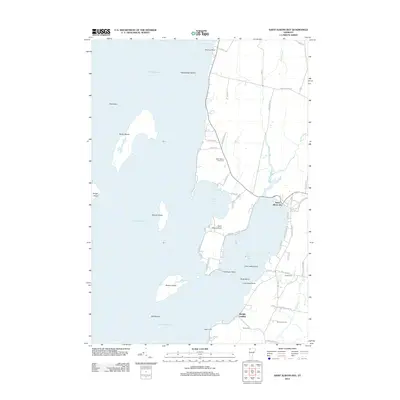
2012 Map of Saint Albans Bay
USGS Topo · Published 2012About this map
Saint Albans Bay defines the eastern shoreline of Lake Champlain on this 2012 survey, where the village of the same name serves as a hub for the surrounding lakeside community. The landscape is characterized by a complex network of points and islands, including the prominent Butler Island, Woods Island, and Burton Island, the latter of which features Eagle Bay. This modern record of Franklin County reveals the transition between the developed waterfront at Melville Landing and the inland agricultural tracts of Burtland Farms. Genealogists will find several burial grounds noted across the terrain, from Saint Albans Point Cem near the northern shore to the Evarts Cem, Waller Cem, and Torrey Cem further south. Numerous coastal roads like Georgia Shore Rd and Hathaway Point Rd trace the irregular coastline, providing access to landmarks like Lime Rock Point and Lazy Lady Island.
Find a feature on this map
67 named features on this map. Tap any name to fly to it.
Don’t see what you’re looking for? This feature index may not catch every label — zoom into the map to look around manually.
Map Details
Editions of this 2012 Saint Albans Bay Map
This is the sole edition of this map. No revisions or reprints were ever made.
Other maps of this area

1894 · Plattsburg
USGS Topo · 1:62,500

1895 · Rouse Point
USGS Topo · 1:62,500

1906 · Plattsburg
USGS Topo · 1:62,500

1907 · Rouse Point
USGS Topo · 1:62,500

1913 · Milton
USGS Topo · 1:48,000

1914 · St. Albans
USGS Topo · 1:48,000

1915 · Milton
USGS Topo · 1:62,500

1916 · St. Albans
USGS Topo · 1:62,500

1939 · Rouses Point
USGS Topo · 1:62,500

1939 · Plattsburg
USGS Topo · 1:62,500