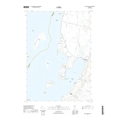
2018 Map of Saint Albans Bay
USGS Topo · Published 2018About this map
Saint Albans Bay dominates this section of the Lake Champlain shoreline, where the protected waters meet the narrow peninsula of Saint Albans Point. The area's agricultural and maritime history is etched into the landscape through its numerous small family burial grounds, including the Saint Albans Point Cem, Evarts Cem, Torrey Cem, and Hurlbut Cem. These sites, along with landings like Melville Landing, suggest a legacy of small-scale commerce and community settlement along the eastern shores of the lake.
Find a feature on this map
61 named features on this map. Tap any name to fly to it.
Don’t see what you’re looking for? This feature index may not catch every label — zoom into the map to look around manually.
Map Details
Editions of this 2018 Saint Albans Bay Map
This is the sole edition of this map. No revisions or reprints were ever made.
Other maps of this area

1894 · Plattsburg
USGS Topo · 1:62,500

1895 · Rouse Point
USGS Topo · 1:62,500

1906 · Plattsburg
USGS Topo · 1:62,500

1907 · Rouse Point
USGS Topo · 1:62,500

1913 · Milton
USGS Topo · 1:48,000

1914 · St. Albans
USGS Topo · 1:48,000

1915 · Milton
USGS Topo · 1:62,500

1916 · St. Albans
USGS Topo · 1:62,500

1939 · Rouses Point
USGS Topo · 1:62,500

1939 · Plattsburg
USGS Topo · 1:62,500