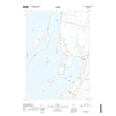
2021 Map of Saint Albans Bay
USGS Topo · Published 2021About this map
Lake Champlain dominates this coastal survey, where the village of Saint Albans Bay sits at the edge of its eponymous inlet. The landscape is defined by the drainage patterns of several key waterways, including Jewett Brook, Stevens Brook, and Rugg Brook, which flow toward the lake's eastern shore. The coastline is particularly complex here, featuring the protected waters of Lapans Bay and a series of smaller points and coves. This modern map provides a clear view of the established road networks and shoreline development near Swanton, reflecting the ongoing relationship between this Franklin County community and the water. The topographic detail highlights the low-lying wetlands and gradual elevation changes that characterize this part of the Champlain Valley.
Find a feature on this map
6 named features on this map. Tap any name to fly to it.
Don’t see what you’re looking for? This feature index may not catch every label — zoom into the map to look around manually.
Map Details
Editions of this 2021 Saint Albans Bay Map
This is the sole edition of this map. No revisions or reprints were ever made.
Other maps of this area

1894 · Plattsburg
USGS Topo · 1:62,500

1895 · Rouse Point
USGS Topo · 1:62,500

1906 · Plattsburg
USGS Topo · 1:62,500

1907 · Rouse Point
USGS Topo · 1:62,500

1913 · Milton
USGS Topo · 1:48,000

1914 · St. Albans
USGS Topo · 1:48,000

1915 · Milton
USGS Topo · 1:62,500

1916 · St. Albans
USGS Topo · 1:62,500

1939 · Rouses Point
USGS Topo · 1:62,500

1939 · Plattsburg
USGS Topo · 1:62,500