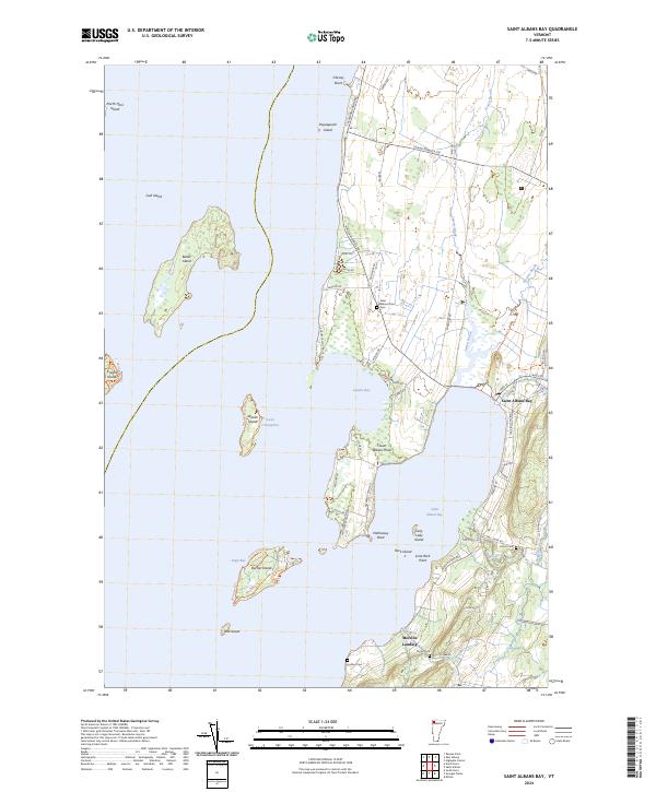
2024 Map of Saint Albans Bay
USGS Topo · Published 2024About this map
Lake Champlain dominates the western half of this landscape, its waters interrupted by a series of significant landmasses including Butler Island, Woods Island, and Burton Island. The shoreline is deeply indented by Lapans Bay and the larger Saint Albans Bay to the south, where the settlement of Saint Albans Bay serves as a focal point for the surrounding road network. The map reveals a high density of named shoreline features, from Saint Albans Point to Lime Rock Point, indicating a coast deeply integrated with local navigation and residence.
Find a feature on this map
69 named features on this map. Tap any name to fly to it.
Don’t see what you’re looking for? This feature index may not catch every label — zoom into the map to look around manually.
Map Details
Editions of this 2024 Saint Albans Bay Map
This is the sole edition of this map. No revisions or reprints were ever made.
Other maps of this area

1894 · Plattsburg
USGS Topo · 1:62,500

1895 · Rouse Point
USGS Topo · 1:62,500

1906 · Plattsburg
USGS Topo · 1:62,500

1907 · Rouse Point
USGS Topo · 1:62,500

1913 · Milton
USGS Topo · 1:48,000

1914 · St. Albans
USGS Topo · 1:48,000

1915 · Milton
USGS Topo · 1:62,500

1916 · St. Albans
USGS Topo · 1:62,500

1939 · Rouses Point
USGS Topo · 1:62,500

1939 · Plattsburg
USGS Topo · 1:62,500