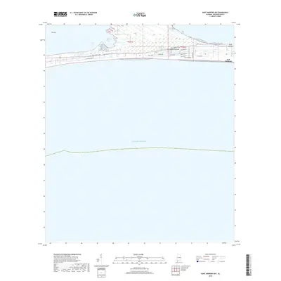
2018 Map of Saint Andrews Bay
USGS Topo · Published 2018About this map
The Fort Morgan Peninsula stretches between the open waters of the Gulf of Mexico and the sheltered inlets of Saint Andrews Bay and Navy Cove. This narrow strip of Baldwin County land is characterized by a landscape of coastal wetlands and sandy stretches, including the western tip known as The Spit. The area shows a distinct pattern of residential development concentrated along the southern shore near Gulf Highlands, where streets such as Beach Blvd and Dixie Graves Pkwy provide access to the waterfront. Toward the northeast, the terrain transitions into more marshy environments near Hog Bayou and Three Rivers, while the eastern portion includes the wooded ground of Edith Hammock. This map provides a clear picture of the modern coastal infrastructure and the fragile geography of the Alabama coast.
Find a feature on this map
22 named features on this map. Tap any name to fly to it.
Don’t see what you’re looking for? This feature index may not catch every label — zoom into the map to look around manually.
Map Details
Editions of this 2018 Saint Andrews Bay Map
This is the sole edition of this map. No revisions or reprints were ever made.
Other maps of this area

1921 · Point Clear
USGS Topo · 1:62,500

1921 · Dauphin Island
USGS Topo · 1:62,500

1921 · Delchamps
USGS Topo · 1:62,500

1941 · Cedar Point
USGS Topo · 1:62,500

1941 · Weeks Bay
USGS Topo · 1:62,500

1942 · Fort Morgan
USGS Topo · 1:62,500

1943 · Cedar Point
USGS Topo · 1:62,500

1943 · Weeks Bay
USGS Topo · 1:62,500

1953 · Mobile
USGS Topo · 1:250,000

1957 · Mobile
USGS Topo · 1:250,000