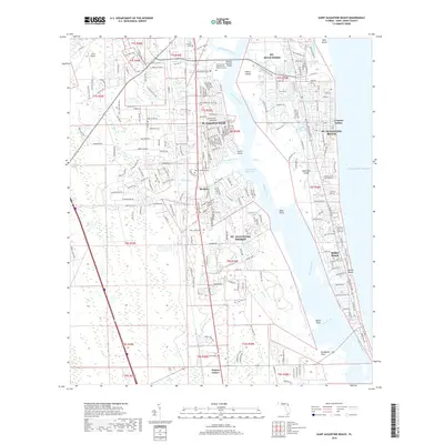
2018 Map of Saint Augustine Beach
USGS Topo · Published 2018About this map
Anastasia Island and the coastal barrier landscape dominate this 2018 survey, showing the established residential patterns south of the historic city. The Matanzas River and the Intracoastal Waterway carve through the center of the map, separating the mainland communities of Moultrie and St. Augustine Shores from the beachside developments of St. Augustine Beach and Butler Beach. The inclusion of the Mickler Oconnel Bridge and Co RD A1A highlights the critical transportation links that define life along the Atlantic coast.
Find a feature on this map
262 named features on this map. Tap any name to fly to it.
Don’t see what you’re looking for? This feature index may not catch every label — zoom into the map to look around manually.
Map Details
Editions of this 2018 Saint Augustine Beach Map
This is the sole edition of this map. No revisions or reprints were ever made.
Other maps of this area

1927 · Matanzas
USGS Topo · 1:48,000

1937 · Bakersville
USGS Topo · 1:24,000

1937 · Elkton
USGS Topo · 1:24,000

1937 · Crescent Beach
USGS Topo · 1:24,000

1937 · Dinner Island
USGS Topo · 1:48,000

1937 · St. Augustine
USGS Topo · 1:24,000

1943 · St. Augustine
USGS Topo · 1:62,500

1943 · Dinner Island
USGS Topo · 1:62,500

1943 · Matanzas
USGS Topo · 1:62,500

1944 · Dinner Island
USGS Topo · 1:62,500
Featured Places
- Saint Augustine, FL
- Saint Augustine Beach, FL
- Saint Augustine South, FL
- Saint Augustine Shores, FL
- Butler Beach, FL