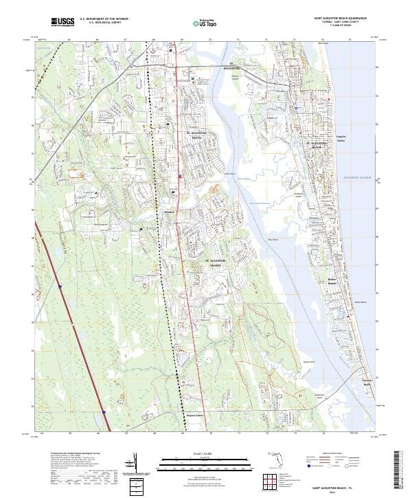
2024 Map of Saint Augustine Beach
USGS Topo · Published 2024About this map
The Matanzas River and the Intracoastal Waterway carve through this coastal landscape, separating the mainland from Anastasia Island and its string of Atlantic communities. Residential expansion is evident in the structured layouts of St. Augustine South, St. Augustine Shores, and St. Augustine Beach. The map preserves important genealogical sites, including San Lorenzo Cem near the University of Saint Augustine For Health Sciences and the smaller Hughes Cem and Barnes Cem located further south near Moultrie. Long-standing coastal geography is marked by points such as Lewis Point, Moss Point, and Braddocks Point, while the southern reaches show the transition toward Crescent Beach and Dupont Center. This modern survey illustrates the dense intersection of recreational trails like the Florida Circumnavigational Paddling Trl with established maritime and suburban infrastructure.
Find a feature on this map
39 named features on this map. Tap any name to fly to it.
Don’t see what you’re looking for? This feature index may not catch every label — zoom into the map to look around manually.
Map Details
Editions of this 2024 Saint Augustine Beach Map
This is the sole edition of this map. No revisions or reprints were ever made.
Other maps of this area

1927 · Matanzas
USGS Topo · 1:48,000

1937 · Bakersville
USGS Topo · 1:24,000

1937 · Elkton
USGS Topo · 1:24,000

1937 · Crescent Beach
USGS Topo · 1:24,000

1937 · Dinner Island
USGS Topo · 1:48,000

1937 · St. Augustine
USGS Topo · 1:24,000

1943 · St. Augustine
USGS Topo · 1:62,500

1943 · Dinner Island
USGS Topo · 1:62,500

1943 · Matanzas
USGS Topo · 1:62,500

1944 · Dinner Island
USGS Topo · 1:62,500
Featured Places
- Saint Augustine, FL
- Saint Augustine Beach, FL
- Saint Augustine South, FL
- Saint Augustine Shores, FL
- Butler Beach, FL